

Forecasters Warn 50-Foot Waves Can Turn Beach Logs Into Deadly Projectiles as Pacific Storms Hit US West
Forecasters urged people to avoid exposed beaches as heavy surf, sneaker waves, coastal flooding and strong winds were expected from Northern California to Oregon
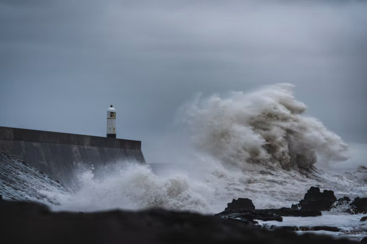
Occasional breakers as high as 50 feet were forecast for exposed stretches of the US West Coast as a Pacific storm brought heavy rain, mountain snow and strong winds. The National Weather Service warned beachgoers to keep well clear of large logs, which surging water can lift or roll along the shore.
The highest surf was expected from Northern California to the Oregon coast through early Sunday, 15 November, with officials warning that people caught in a log's path could be seriously injured or killed.
The threat is not limited to swimmers. Powerful waves can pick up heavy beach logs and send them surging up the shore towards anyone in their path. The National Weather Service (NWS) has told people to keep well away from them.
Why Powerful Surf Makes Beach Logs Dangerous
The 50-foot figure applies only to occasional breakers at the most exposed spots, not to the whole coastline. The Weather Channel said on Saturday, 14 November, that waves could reach 30 feet in nearshore waters and break as high as 50 feet at favoured spots, most likely between Northern California and the Oregon coast.
In California, the NWS office in San Francisco issued a High Surf Warning for breaking waves of 25 to 35 feet, with occasional sets of 40 to 50 feet at favoured breakpoints. The warning was in force until 4am local time on Sunday.
Further north, NWS Portland forecast breakers of 30 to 35 feet along the north and central Oregon coast on Saturday morning. The agency warned that water running up the beach can lift or roll large logs, injuring or killing anyone caught in their path.
Waterlogged logs can weigh hundreds of pounds, according to NWS safety guidance, and sneaker waves can run more than 150 feet up the beach without warning. The agency says log rolls have proven fatal. During a 2020 storm, Cannon Beach Mayor Sam Steidel told Oregon Public Broadcasting: "I personally have seen 40-foot logs tossed around like toothpicks."
Storms Bring More Rain, Snow and Coastal Flooding
Boaters along the coast were also warned. The NWS office in Medford, Oregon, urged mariners to remain in port, secure their vessels and keep checking updated forecasts.
High tides could make coastal flooding worse. The Weather Channel said raised water levels linked to El Niño, combined with high tides, could push water further inland along the coast. NOAA's Climate Prediction Center said on 12 November that El Niño was still strengthening, with a strong-to-very-strong event likely through January to March 2027.
Inland, heavy rain and high-elevation snow were forecast for parts of Washington, Oregon and Northern California on Sunday, with 1 to 2 inches of rain possible. The system was then expected to move towards the Intermountain West on Monday, while the southern Sierra Nevada could see 1 to 2 feet of snow by Monday evening.
Another storm is forecast to reach Northern California on Wednesday. It could bring 3 to 6 inches of rain to southern Oregon, far Northern California, the northern Sierra Nevada foothills and Washington's Olympic Peninsula.
Forecasters warned that later storms could raise the risk of flooding, especially around wildfire burn scars, where mudslides and debris flows are possible. Widespread inland flooding was not expected from the first system, and much of its rain was described as beneficial. Officials urged people to follow local warnings and check the latest forecasts before travelling or heading to the coast.
© Copyright IBTimes 2026. All rights reserved.