Monster Tornado Threat Sparks Concern Across Central US as Violent Storms Barrel Towards Millions of People
Forecasters warn of powerful tornadoes and destructive weather across multiple states.
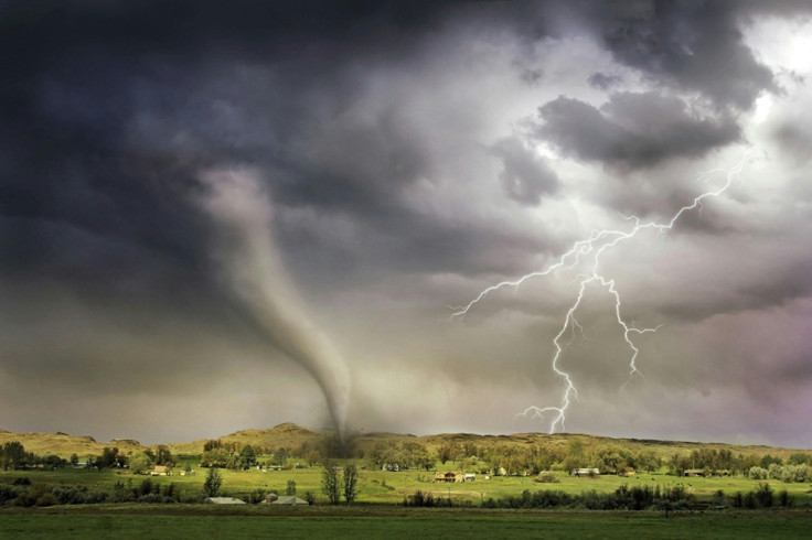
A dangerous rash of severe storms is sweeping across the central United States, with forecasters warning that powerful tornadoes, giant hail and destructive winds could wreak havoc through Monday night.
Millions of Americans across several states have been placed on high alert as meteorologists fear the volatile weather system may trigger multiple intense tornadoes.
The National Weather Service's Storm Prediction Centre has issued a Level 4 out of 5 severe weather warning for parts of Kansas and Nebraska, signalling a significant risk of strong tornadoes and widespread storm damage.
Experts say atmospheric conditions are rapidly becoming ideal for dangerous supercell thunderstorms capable of producing EF2 or stronger tornadoes.
Tornado Alley Braces for Violent Storms
The most serious threat is expected to stretch from central Kansas into south-eastern Nebraska, although severe weather risks extend from Texas all the way to the Great Lakes.
Cities including Topeka, Omaha, Sioux Falls and parts of Missouri are among those preparing for potentially life-threatening conditions.
Forecasters warned that isolated supercell storms could unleash 'monster hail' larger than three inches in diameter, hurricane-force wind gusts and long-track tornadoes.
Some meteorologists fear the outbreak could become one of the most significant severe weather events of the spring season so far.
Saturday already brought dramatic scenes across parts of Kansas and Missouri, where hailstones smashed windows, and strong winds caused damage in several communities.
Reports also emerged of multiple tornado sightings as the storm system intensified across the Plains.
Millions Told to Prepare for Tornadoes
Emergency officials have urged residents across the threatened regions to remain alert and prepare shelter plans in case tornado warnings are issued.
Weather experts stressed that storms could rapidly intensify during the late afternoon and evening hours when atmospheric instability peaks.
The current weather pattern has been fuelled by warm, moisture-rich air surging northwards from the Gulf of Mexico, colliding with cooler air and powerful jet stream winds. This volatile combination is creating ideal conditions for rotating thunderstorms capable of spawning tornadoes.
The threat is expected to continue into Tuesday, with additional storms forecast to push eastwards towards the Midwest and Great Lakes region.
Areas of Michigan and northern Texas are also facing heightened risks of hail, flooding and damaging winds as the storm system expands.
Some schools and local authorities have already begun reviewing emergency procedures amid fears that the storms could disrupt travel, power supplies and public services across multiple states.
Fears of Another Devastating Tornado Outbreak
The renewed severe weather threat comes after a turbulent year for tornado activity across the United States.
Earlier outbreaks in 2026 caused widespread destruction across parts of the Midwest and South, with dozens of tornadoes reported in several states.
Meteorologists say May is traditionally one of the most active months for tornadoes in the central US, but recent atmospheric changes have made forecasting increasingly unpredictable.
Experts warn that even a slight shift in storm development could dramatically increase the risk of violent tornadoes.
Residents have been urged to monitor weather alerts closely, charge mobile phones and identify safe shelter locations as the dangerous storm system continues to strengthen.
Forecasters warned that conditions may change quickly and that some communities could have only minutes to react if tornado sirens begin blaring.
© Copyright IBTimes 2025. All rights reserved.
- Recommended For You