Noah's Ark Found? Radar Scans Reveal 3 Underground Decks and 13-Foot Hidden Tunnel in Turkey
Independent scientists have yet to verify the claims, and the team behind the scans plan deeper drilling and testing before drawing firm conclusions.
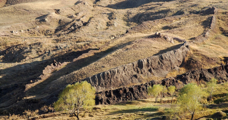
Archaeologists in eastern Turkey say new radar scans have revealed a three‑decked, ship‑shaped structure and a 13‑foot tunnel buried beneath a remote mountainside, renewing claims that the legendary Noah's Ark may lie at the Durupinar Formation near Mount Ararat.
The fresh evidence, gathered by an American team working under the banner Noah's Ark Scans over several years, centres on ground‑penetrating radar images that researchers argue align strikingly with the Biblical description of Noah's Ark.
Noah's Ark Searches Focus On Turkish Mountain
According to Scripture, Noah's Ark was the vast wooden vessel that carried humanity and animal species through a catastrophic flood more than 4,300 years ago.
Genesis 8 in The Bible says the ark came to rest on the 'mountains of Ararat' after 150 days of deluge, a passage that has fuelled centuries of speculation and expeditions across this rugged corner of eastern Turkey.
The Durupinar site, only recognised by modern researchers for less than a century, appears at first glance to match that story rather neatly.
Its dimensions echo the Biblical blueprint for the ark, given in Genesis 6 as 300 cubits long, 50 cubits wide and 30 cubits high, which translates to about 515 feet by 86 feet by 52 feet. The mound lies near a summit whose outline, from the air, bears a notable resemblance to a hull.
That visual similarity alone has never been enough to convince mainstream science. Many academics still regard the entire formation as the product of natural geological processes. The team behind the latest work, however, argue that their data now point beyond coincidence.
Radar Scans Hint At Three Decks And Inner Corridors
Independent researcher Andrew Jones, who fronts the Noah's Ark Scans project, has led multiple survey seasons at Durupinar using ground‑penetrating radar, a technique that sends radio waves into the earth to map buried structures.
Speaking to the Christian Broadcasting Network, he said the new scans detected what looked like a 13‑foot passage running through the centre of the formation, along with angular shapes that could represent internal compartments.
A fresh analysis of the radar data, shared with outlets including Express UK, suggests a pattern of central and lateral corridors or hallways, rather than a single homogenous block. Crucially for the ark hypothesis, the scans also show three distinct layers below the surface.
Supporters say that aligns with Genesis 6:16, which instructs: 'Make it with lower, second, and third decks.'
Jones is careful not to promise a perfectly preserved ship. 'We're not expecting something that's fully preserved,' he told CBN. 'What's left is the chemical imprint, pieces of wood and in the ground, the shape of a hall.'
He later added that the radar returns were 'not what you'd expect to see if the site were simply a solid block of rock or the result of random mudflow debris.'
He argued instead that the pattern is 'exactly what you'd expect to find if this were a man‑made boat, consistent with the biblical specifications of Noah's Ark.'
Soil Clues And A Possible Hidden Tunnel
The radar work is being paired with basic soil science. William Crabtree, a soil scientist who also works with Noah's Ark Scans, said his team collected 22 samples from inside and outside the boat‑shaped outline.
He told CBN that organic matter levels were roughly double inside the formation compared with the surrounding ground, while potassium levels were about 40 per cent higher and the pH noticeably different.
'If you know soil science – as I'm a soil scientist – you'll understand that potassium levels, organic matter, and pH can all be influenced by decaying organic material,' Crabtree said. 'If this was a wooden boat and the wood had rotted over time, we would expect to see elevated levels of potassium, changes in pH, and higher organic content – and that's exactly what we're finding.'
Jones also pointed to a change in vegetation, saying grass growing within the boat‑shaped perimeter appeared a different colour from that just outside, which he believes may hint at human construction beneath.
Alongside the three radar‑defined layers and compartment‑like shapes, the team say they have identified a tunnel‑like feature. Jones described what seems to be a 13‑foot passage extending from the tip of the formation towards its centre, with sufficient space for a person to walk through.
To date, this remains an interpretation of the scans; the structure has not been physically entered or excavated.
Debate Over Noah's Ark Discovery Far From Settled
The Durupinar Formation has split opinion for decades. Some geologists argue the mound's outline and internal patterns can be explained by erosion and natural faulting, with no need to invoke a vast timber hull. Others, often working from a faith background, continue to see it as one of the most promising candidates for Noah's Ark.
Jones presents his project as scientific rather than devotional, though he readily acknowledges the religious significance. Noah's Ark sits at the heart of Judaism, Christianity and Islam, and the flood narrative speaks to broader questions of survival, judgement and the power of nature.
For believers, physical evidence of the ark would be a profound validation. For many scientists, on the other hand, the story remains a myth into which data are too easily forced.
The Noah's Ark Scans team say they are only at the start of their investigation. They plan to extend soil sampling beyond the initial 22 tests, carry out core drilling to bring up physical material from deeper layers, and run further ground‑penetrating radar surveys to refine their picture of what lies under the surface. Any excavation or drilling would require Turkish permits and close oversight.
Jones himself has framed the next steps simply: 'We want to compare what's inside the formation to what's outside. That could give us a much clearer picture of whether this is truly something man‑made.'
The Durupinar Formation sits about 18 miles south of Mount Ararat, Turkey's highest peak, and has intrigued explorers and believers since it was exposed by storms and seismic activity in 1948.
The boat‑shaped mound, roughly 538 feet long, has long been touted by some as the resting place of the ark described in Genesis, while many geologists maintain it is simply a natural rock feature. The latest radar work is the most detailed attempt yet by this particular group to test those rival theories.
© Copyright IBTimes 2025. All rights reserved.
- Recommended For You