Don't Trust Your Sat-Nav: Fleeing Drivers Guided Into Path of Infernal BC Wildfire by Phone Apps
State of emergency declared as wildfire threatens communities and forces evacuations
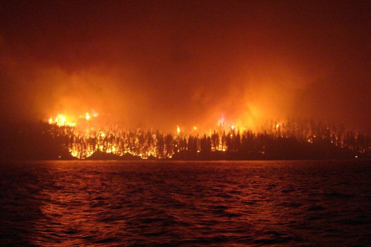
British Columbia's Bald Range wildfire has exploded to almost double its size in a single night, surging from 50 square kilometres to an estimated 95–100 square kilometres (9,500 hectares) and forcing more than 20,000 residents to flee as phone navigation apps reportedly send drivers towards the flames.
Search-and-rescue officials say GPS apps are rerouting people escaping the closure of Highway 97 onto a remote forest road that leads straight into the fire's path.
Premier David Eby declared a province-wide state of emergency on Saturday, 8 August 2026. This grants authorities powers to restrict travel, secure accommodation for evacuees, prevent price gouging and ration fuel if required. However, the declaration does not automatically unlock extra firefighting funding.
Officials say the fire has reached 'Rank 5' behaviour, the most dangerous classification. It is producing an organised flame front, with embers jumping up to a kilometre ahead of the blaze. Officials describe it as being 'like a bomb going off'.
Cause Under Investigation as Conditions Worsen
The cause of the Bald Range fire remains under investigation. Officials noted no lightning was recorded in the area when it started, pointing to a possible human origin.
Human-caused climate change has doubled the likelihood of the dry conditions behind the blaze. Prolonged drought, poor winter snowpack and recent heatwaves have left vegetation extremely dry. Decades of fire suppression have also allowed fuel to build up in forests that naturally depend on periodic burning.
20,000 Residents Displaced and Key Highway Cut
More than 20,000 people have fled, including the entire community of Summerland, around 12,000 people, and roughly 8,000 from Peachland.
The fire covered some 15 kilometres toward Okanagan Lake in just a few hours, cutting off road access for many.Highway 97 remains closed in both directions between Peachland and Penticton.
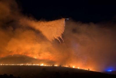
Eighteen firefighting aircraft were diverted from suppression duties to rescue more than 50 people trapped behind fire lines. Search-and-rescue crews are continuing to check the area for anyone left behind. The RCMP is investigating a possible wildfire-related death near Summerland. The community has also lost power and is under a boil-water notice after untreated water entered the system.
Interior Health relocated 238 seniors from care facilities, including 190 from Summerland Seniors Village and 48 from the Dr Andrew Pavilion. Anyone needing urgent medical care in the area was directed to Penticton Regional Hospital.
GPS Apps 'Sending Drivers Towards the Fire'
Search-and-rescue officials (COSAR) have issued a stark warning that navigation apps, including Google Maps and Apple Maps, are rerouting motorists fleeing the closed Highway 97 onto the Summerland-Peachland Forest Service Road.
This unpaved, remote route can lead drivers directly into the path of the active fire. Officials are urging residents to ignore GPS shortcuts and rely solely on DriveBC for verified closures and safe evacuation routes.
Residents can visit DriveBC.ca or follow @DriveBC on X for the latest on highway status and travel advisories. DriveBC also provides highway webcams offering a visual assessment of current conditions.
Residents have used the Callan Road webcam north of Summerland to monitor fire activity and confirm reports of flames jumping the highway.
Support and Shelter for Evacuees
Reception centres have opened at the Penticton Trade and Convention Centre and the Westbank Lions Community Centre in West Kelowna, with group lodging available at Royal LePage Place and RV parking at Boucherie Secondary School.
Evacuees are encouraged to register with Emergency Support Services online for food, clothing and mental health support. An Animal Lifeline Emergency Response Team is based at the Penticton centre, while some residents have opened their own riding rings to shelter neighbours' horses.
Officials say conditions are changing "minute by minute," with air rescue remaining the priority as crews continue to monitor the fire's advance toward populated areas.
© Copyright IBTimes 2026. All rights reserved.
- Recommended For You