UN Warns Climate 'Danger Zone' Is Here: 6°C Pacific Heat Spike Risks Historic 'Super El Niño'
El Niño conditions return, raising fears of a historic heat spike and global climate impacts.

The UN weather agency has warned that the world is entering a climate 'danger zone' after confirming on Tuesday that El Niño conditions have returned in the Pacific Ocean, with sea surface temperatures in some tropical areas running about 6°C above average and raising the risk of a historic 'super El Niño' heat spike between June and November 2026.
The news came after months of mounting concern among climate scientists that the Pacific was primed for another powerful El Niño, barely two years after the 2023–24 event helped drive global temperatures to record highs. That episode was one of the five strongest on record and pushed heat, drought and flooding into what researchers openly described as 'uncharted territory.'
This time, the UN's World Meteorological Organisation (WMO) and the US National Oceanic and Atmospheric Administration (NOAA) say the background conditions are even more alarming because the planet is already around 1.3°C warmer than in pre‑industrial times.
UN Climate Warning Puts Heat Spike in Stark Relief
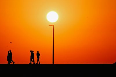
El Niño is a naturally recurring climate pattern, born from unusually warm surface waters in the central and eastern equatorial Pacific. When that water heats up, it disrupts the usual trade winds and jet streams, sending knock‑on effects across the globe. South‑east Asia and Australia are more likely to face drought. Parts of the Americas tend to see heavier rains and floods. Marine life struggles as heatwaves spread through the oceans. Farmers from Peru to Indonesia watch their harvests with a degree of dread whenever the cycle turns.
What has officials using the sort of language they normally reserve for emergency briefings is the intensity of the current warming. According to UN‑backed monitoring cited by the WMO, some stretches of the tropical Pacific are already around 6°C above their seasonal norm. Forecasts released in May projected that El Niño conditions have a 90% chance of persisting from June through November 2026, with several models pointing towards a very strong event by the northern hemisphere autumn.
Forecasters reach for a shorthand when an El Niño crosses a certain line. A 'super El Niño' is not a formal category in treaty language; it is the label used by forecasters and outlets such as National Geographic when Pacific sea surface temperatures climb at least 2°C above average over key equatorial regions. Historically, those spikes have been associated with cascading failures in weather systems: searing droughts, catastrophic floods and widespread land and marine heat records.
Super El Niño to be the strongest EVER recorded: New predictions suggest global sea temperatures could be 4˚C above average later this year https://t.co/AVCBxnAmwr
— Daily Mail (@DailyMail) June 8, 2026
The 2023–24 El Niño, strong though it was, developed over an ocean that had not yet seen the full punch of the last two years of warming. Now, as NOAA notes in its own outlook, temperatures across the tropical Pacific are rising rapidly from a hotter starting point, and the agency says conditions are 'increasingly favourable' for a strong El Niño to form by late 2026 and potentially extend into early 2027. The WMO's probabilities and NOAA's modelling are broadly aligned, even if the exact peak intensity remains uncertain.
Super El Niño Fears Collide With Fossil Fuel Reality
UN Secretary‑General António Guterres has been unusually blunt about what another major El Niño would mean in a world that has not weaned itself off fossil fuels. He has warned that the developing pattern could add 'more fuel to the fire' of global warming, with coal, oil and gas still providing the bulk of the world's energy and keeping carbon dioxide emissions hovering around record levels.
Climate experts are careful on one point. El Niño itself is not caused by climate change. It is part of the El Niño–Southern Oscillation, a natural swing in the climate system that has been affecting Pacific weather for centuries. The very name 'El Niño' dates back to Peruvian and Ecuadorean fishermen who noticed the warm waters arriving around Christmas and nicknamed the phenomenon 'the little boy.' Every El Niño‑linked heatwave, drought or flood now plays out in an atmosphere and ocean system already loaded with extra heat trapped by greenhouse gases.
A recent NOAA study, referenced by UN officials, goes further and suggests that under higher greenhouse gas scenarios, El Niño events later this century are likely to become more intense and longer‑lasting. That prospect unsettles researchers because it implies future cycles will not just ride on top of global warming, but actively amplify its worst expressions.
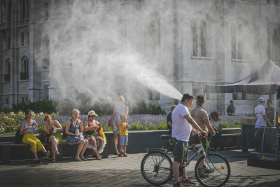
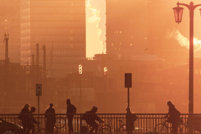
None of this is academic for the people who have to plan around it. Governments, farmers and disaster agencies are being urged by scientists to prepare now rather than wait for the headlines that will follow the first crop failures or failed monsoon. A strong or super El Niño would be expected to push global average temperatures 'above average nearly everywhere,' as one summary of the latest forecasts puts it. In practice that means higher odds of heat extremes in already hot cities, more stress on water supplies, and emergency services forced into a reactive stance as concurrent disasters stack up.
The reliance of the global economy on fossil fuels is well documented. Yet carbon emissions remain stubbornly high, and the world is heading into what could be one of the most defining climate events of the decade with the same underlying vulnerabilities that were exposed in 2023–24, only more so.
Scientists are transparent about the limits of their foresight. Not everything about the coming El Niño is confirmed, and the precise strength, timing and regional fallout could yet diverge from current models, so some projections should still be taken with a grain of salt. What is not in doubt is that the Pacific is heating, the odds of a powerful El Niño are rising, and the decisions made before it peaks will help determine whether it is remembered as a brutal but manageable shock, or something closer to a warning that went largely unheeded.
© Copyright IBTimes 2025. All rights reserved.
- Recommended For You