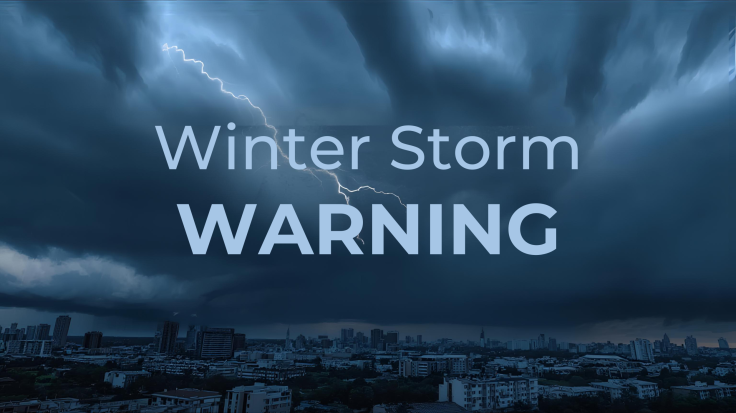
Winter Storm Warning: National Weather Service Warns Blizzards to Drop 3 Feet of Snow as July Begins
When summer plans meet mountain weather, it is the calendar, not the storm, that usually blinks first.
A 'Winter Storm Warning' in the final days of June is set to bring heavy snow of up to three feet and winds gusting to 60mph to parts of the western United States this week, according to the US National Weather Service. The late-season system is forecast to hit high elevations in the Sierra Nevada and Cascades from Sunday 28 June into Monday 29 June, just as Americans prepare for July celebrations.
The alarm from the Weather Prediction Center lands at the very moment many Americans are planning barbecues and fireworks rather than digging out snow chains. Yet meteorologists say conditions in parts of Washington, Oregon, California, Nevada and the northern Rockies will look and feel far closer to early spring than high summer, particularly above 6,500 to 7,000 feet where the bulk of the accumulating snow is expected.

Winter Storm Warning Targets Sierra Nevada and Cascades
The Weather Prediction Center report, issued through the National Weather Service, highlighted a swathe of mountain terrain stretching along the US West Coast as being in the firing line of this unusual 'Winter Storm Warning.' Forecasters say snow is already appearing in some north-western ranges and will intensify overnight into Sunday, then linger into Monday across the higher peaks of the Cascades, down into the Sierra, the Uinta Mountains and the northern US Rockies.
The Wyoming Department of Transportation (WYDOT) has already flagged deteriorating conditions in transport advisories. In a statement, WYDOT said: 'Snow is already beginning to fall in some of the Northwest Mountains this late afternoon and increasing snow will continue tonight through Sunday lingering into Monday for the higher elevations of the Cascades, down into the Sierra, the Uinta and the Northern U.S. Rockies.'
The focus is firmly on elevation. Below roughly 6,500 feet, most lower valleys are expected to see cold rain and blustery conditions. Above that threshold, however, the system has enough cold air to deliver what officials describe as 'potentially heavy snowfall,' with isolated locations at the highest ridges at risk of accumulating totals that could approach three feet over the course of the event.

Unseasonal Snow Raises Safety Fears in Recreation Hotspots
The warning is not merely about an odd weather statistic. It intersects awkwardly with the start of the peak outdoor season in western parks and mountain resorts. It also reminds us of an incident from last year at Lake Tahoe, the high-altitude lake that straddles the California–Nevada border.
In 2023, eight people died on Lake Tahoe in a boating accident during what was described as a 'rare June storm' that whipped up dangerous conditions and dusted the surrounding mountains with fresh snow. Hikers and backpackers were caught out by that sudden blast of wintry weather, and local broadcasters are clearly wary of a repeat.

June snow has been recorded around Lake Tahoe from 1910 all the way through to 2024, and similar surprises cannot be ruled out in early July either. That long record does not make this week's forecast less disruptive, but it does underline that the Sierra Nevada has a habit of ignoring the calendar.
National Weather Service meteorologist Gigi Giralte underlined the potential shock factor for people heading into the backcountry this weekend. 'The snow could come as a shock for people that might be recreating or camping or starting out on an early morning hike,' she said, adding that the setup is 'definitely more reminiscent of springtime weather' and 'a little abnormal to see in late June.'
The pattern is a jarring one. Residents in nearby towns may experience one day of poolside warmth and the next day waking to temperatures that feel 'colder-than-average' for the season, along with views more suited to a February ski break than a July holiday.

Winter Storm Warning Also Flags 60mph Winds and Fire Risk
The 'Winter Storm Warning' is not confined to snow and cold. Across eastern and southern Nevada and neighbouring valleys, forecasters expect brisk south-westerly winds on Sunday and into the new week, with gusts that could reach 60mph in exposed areas.
While the mountain tops contend with sudden snow, that strength of wind over already dry lower ranges raises a different concern altogether: fire danger. Strong gusts can rapidly fan any small ignition, turning what would otherwise be a routine breeze into a serious hazard for ranchlands, roadways and rural communities.
The National Weather Service has also highlighted the Ruby Mountains of north-eastern Nevada, particularly in Elko County, as another area to watch. On Sunday, the agency warned of a combination of snow at higher elevations, freezing temperatures and 'widespread frost after midnight.' The stated chance of precipitation, including snow aloft, stood at 50%.
Other broadcasts are carrying similar alerts for high-altitude zones in Washington state, again focused on the uppermost reaches rather than cities and suburbs. There is no suggestion that major metropolitan centres will see accumulating snow; the concern is instead for travellers, hikers, campers and anyone who assumes a late-June forecast cannot possibly involve winter driving conditions.
None of the agencies involved suggest a long, season-breaking cold snap. This looks to be, in their own framing, a 'quick burst' of snow and wind that temporarily halts summer in its tracks before temperatures recover. But until the system clears, officials are urging caution: check forecasts carefully, carry winter gear if heading into the mountains, and do not underestimate a storm simply because the calendar insists it is nearly July.
© Copyright IBTimes 2025. All rights reserved.
- Recommended For You